USU archaeologists conduct ‘prehistoric’ research in Wyo
Utah State University anthropology professor Chris Morgan is leading a team of researchers this summer investigating why the prehistoric inhabitants of western Wyoming chose to build and live in a large village at nearly 11,000 feet elevation in the Wind River Range. The site, High Rise Village, contains at least 51 houses called wickiups as well as substantial remains from campfires, cooking, tool making and seed grinding, Morgan said.
High-altitude prehistoric villages like the one Morgan and the team are examining are exceedingly rare in the region, he said. Only two other localities are known, one in central Nevada and the other in eastern California. Worldwide, similar occupations have been tied to population growth associated with the development of agricultural and pastoral economies in lowland settings, Morgan said.
Morgan and his team seek to learn if similar conditions led to the use of High Rise Village and possibly other high altitude sites in the area by excavating the site and performing remote-sensing work to discover additional, similar sites nearby. The team includes Morgan, Ken Cannon, Robert Pack and Richard Adams, each bringing a different expertise to the project.
Morgan, an assistant professor in USU’s anthropology program, is interested in high-altitude hunter-gatherer adaptations worldwide. Cannon, director of USU Archaeological Services and an adjunct anthropology professor at USU, is an expert on prehistoric hunting patterns and animal behavior in the greater Yellowstone ecosystem. Pack, an associate professor in USU’s Department of Civil and Environmental Engineering, is an expert in remote sensing. Adams, who works at the state archaeology office in Wyoming and who was a co-discoverer of the site, is an expert in Wind River mountains archaeology.
Together, the team seeks to understand the forces driving high-altitude settlements in the region and explore ways of discovering new and remote alpine villages. In this effort, the team is leading a USU archaeological field school into the mountains to excavate the site. The field school is made up mainly of USU undergraduates, as well as students from California, Wyoming and Iowa.
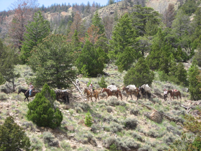
Because the site is in a designated wilderness area, the team must pack its gear to the site on foot, with a string of packhorses bringing in the heavier field equipment and supplies, Morgan said.
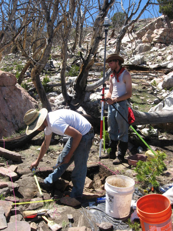
“We will precisely map the site with state of the art surveying equipment on loan from USU’s Spatial Data Collection, Analysis and Visualization Lab and carefully excavate a series of wickiups to recover stone tools, animal and plant remains and carbon used to radiocarbon date when each lodge was occupied,” Morgan said. “Later in the summer, Dr. Pack will use helicopter-mounted LiDAR [similar to radar, but using lasers instead of radio waves] and high-resolution photoimagery to search for additional high altitude villages in the area.”
The subject of high-altitude hunter-gather settlement is an important one.
“In addition to this site helping figure out the local archaeological sequence, it will help us understand how people adapt to high altitudes and their ecological analog at high latitudes,” Morgan said. “This is essential to understanding how people came to occupy most of the globe by the end of the Pleistocene.”
Morgan said finding more sites like the one being excavated by the USU team is essential to refining our understanding of these processes. He hopes the use of remote sensing will make the work much more efficient. He predicts it will be used in similar remote settings in the near future.
I
n addition to National Geographic, the project is funded in part from a grant from the BYU John Topman and Susan Redd Butler Foundation and the College of Humanities and Social Sciences at USU.

Pack train hauling excavation gear and supplies for research at High Rise Village.

USU field school student Forrest Kranda excavates a lodge foundation while student Peter Yaworsky maps the site with precision instrumentation from USU’s Spatial Data Collection, Analysis and Visualization Lab.

